A ride on the "Ring Road".
The thin brown line on the satellite map of Iceland below is Route 1. It runs close to the coast along the South and more inland along the north side of the island. In many parts of the country, it is the only road. The whole circuit adds up to about 850 miles.
My initial plan was to spend about 18 days and ride the ring.
 |
If you click on any picture, you will see it (and all others) full size, but with no text. Click outside the enlarged picture to
return to the vertical display with text. |
.jpg) |
| This map shows a few more details, but the satellite view above gives a better indication of how empty most of the island really is. |
 |
Getting there
The black case on the bottom contains a folded and partly disassembled Bike Friday Llama.
The duffel bag and yellow handlebar bag contains everything else for a three week stay - camping gear, some dried food, clothing etc. It weighed about 100 pounds altogether. Getting it all from NY/JFK to Iceland/Keflavik was easy on Icelandair. Getting it from Philadelphia to New York on a train was rather harder. |
 |
Took a bus from the airport to my hotel (Odinsve) in the middle of the old part of Reykjavik
It was before 10am on May 22 when I arrived, but I had no problem checking in early. Tourist season doesn't really start until mid June. I had one day in Reykjavik to assemble the bike, buy gas for my stove, and to explore the town. It was rather cold and occasionally raining, so I also bought a knit wool hat and matching gloves.
Reykjavik is a really nice place. Most of the population of Iceland lives there, and it would be easy spend a couple of weeks there. |
 |
View from Reykjavik looking across the harbor
|
 |
| The harbor area is about one half for tourists |
 |
| and half commercial |
 |
| The cathedral is the town's tallest building. For a fee you can ride a lift to the top and see all of Reykjavik. |
 |
| The inside is as clean and unadorned as the outside |
 |
| In front, where you might expect its patron Saint, there is a statue of Leif Ericson |
 |
The monument was a gift from the people of America to the people of Iceland on the 1000th anniversary of the Althing.
The Althing was the first Parliament |
 |
| Sampling all the food in Reykjavik would take a much longer trip than I had planned! |
 |
 |
I have yet to try the whale, but the puffin (Iceland's national bird) was quite good.
5900 Icelandic Kroner = $48 |
|
 |
Leaving Reykjavik
Assembled, the bike and accessories looked like this. Light stuff that should stay dry was in the trailer, heavy stuff in the panniers. The handlebar bag contains a camera, gloves, notebook, maps, GPS, cell phone etc.
I had planned to leave early in the morning. The sun sets just after 10 pm and rises around 2 am this time of year and it never actually gets dark, so it shouldn't have mattered when I left town. Unfortunately, it was raining, so I had breakfast at the hotel and waited until around 10 am before starting.
The most direct route out of town would have been southeast towards Selfoss (called Arborg on this Google map). However, most of Iceland's traffic is on this stretch of road, so I decided to go west to Hafnarfjordur, south on Rt 42, then east along the coast to Eyrabakki. Most of this area is fresh lava, and mostly empty. This sounded better than heavy traffic and suburbs, and I wanted to visit the Nature preserve in Eyrabakki.
Getting out of town was not easy. The main roads were not suitable for a bike and the multitude of other roads and bike paths, were not marked in any useful way and often ended at a subdivision or shopping area. I did ask directions many times, but it usually wasn't very helpful. |
 |
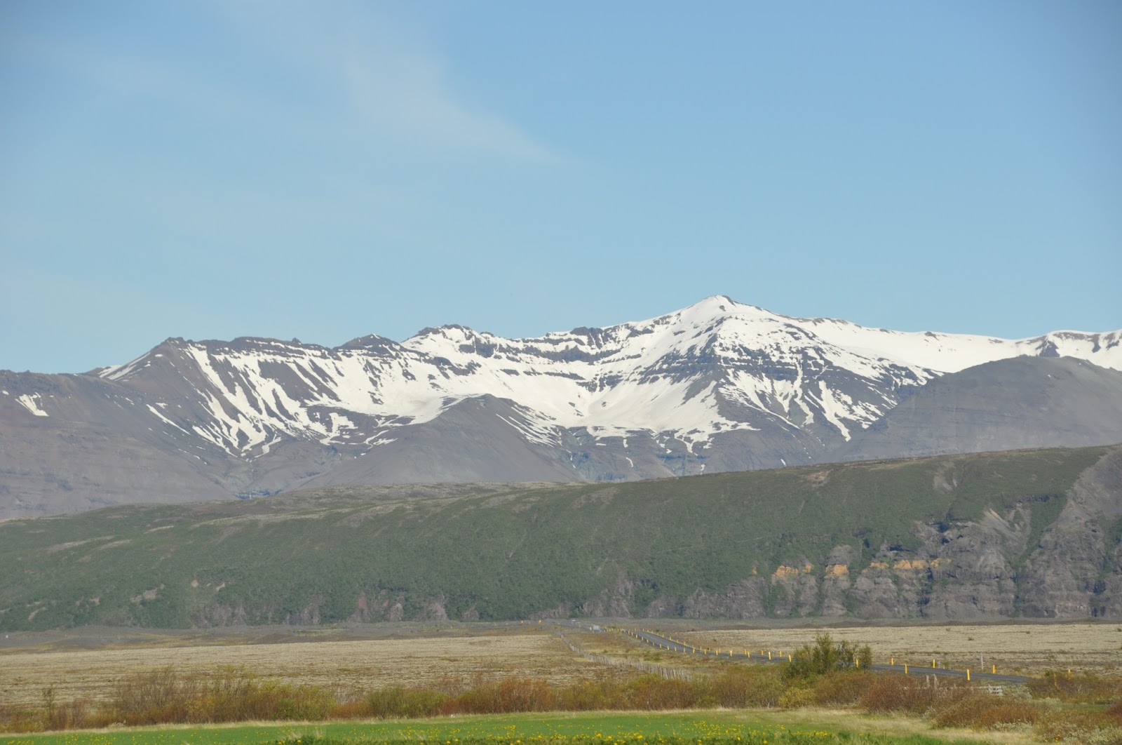
It was late afternoon when I finally decide that I was on the right road.
The "landscape" was rather barren, but like most everywhere there were snow-capped mountains in the distance. |
 |
| Vegetation - almost exclusively lichen |
 |
| Two bikers passed me. I have no idea where they started from or ended. |
 |
| This was the first proof that I was on 42, where I was supposed to be. |
 |
At some point the wind and rain picked up dramatically, the hills got serious and the road deteriorated.
|
 |
Finding a spot with grass, overlooking a large lake, I decided to stop, set up camp and make dinner.
The ropes from the tent to the bike kept the tent from blowing away.
In nice weather this would have been an almost idyllic campsite. |
 |
63.936963, -21.985103
If you put these coordinates into the Google map search bar you will see exactly where I was.
If you find it looks like Sweden, then you left out the minus sign.
 |
The next morning. The weather had, for that moment, improved slightly.
"No fishing without permission" |
|
Day 2 started off like day 1 with on and off light rain. The road improved, but the wind increased as the road approached the coast and headed east. It was mid afternoon before I found a tiny diner (T-baer Kaffihus, near Selvogar). I was the only customer and the woman running the place was one of the few I met who spoke no English. No problem, I was there for close to an hour. By the time I was ready to leave, I had eaten two ham and egg sandwiches, and a large slice of carrot cake, drank two cups of coffee, and dried my gloves on the radiator. I then headed east to the fishing village of Dorlakshofn that was supposed to have a guest house. Two girls on bikes led me to the guest house, but one told me that the owner was a fisherman and he was at sea. However, if I could reach his cell phone he might be able to have his sister come over and given me a room. Aside from being remarkably knowledgeable about her neighbors, the girl's English was far better than anyone else I had spoken with. It turned out that her father was from New York.
The guest house owner-fisherman was not reachable, so I rode out of town a few miles until I found a grassy roadside place for my tent. After a dinner of red beans and rice I slept rather well considering that the wind was threatening to blow the tent away. I left late in the morning. (If you are in a tent and you wake up and it is raining, the obvious thing to do is go back to sleep).
There is a Nature Preserve in Eyrabakki that I had planned to visit, but the weather did not cooperate so I headed toward Selfoss, the first sizable town since Reykjavik. On the way I stopped at Rauda (red door) Restaurant and had their "Catch of the Day". That evening, I was in a cabin at the Selfoss Campground, where I unpacked everything and dried it out. The next morning, I turned onto highway 1 and headed toward Hella.
 |
| A brief moment of sun on the coast |
 |
Dinner at "Arhus" in Hella
Herring, like I have never seen! |
 |
The ride from Selfoss to Hella was in more rain and against a 40-50Kph wind.
When I got to the reception of the guest house/restaurant the owner jumped up and with a huge grin, said "I knew you would be here. I saw you on the road". Several of the guests had also seen me, and some were bikers who knew how hard it was under those conditions.
63.833057, -20.407948 |
Not a photo-op
A police speed-trap camera. I was not worried!
They go faster, but I see more
 |
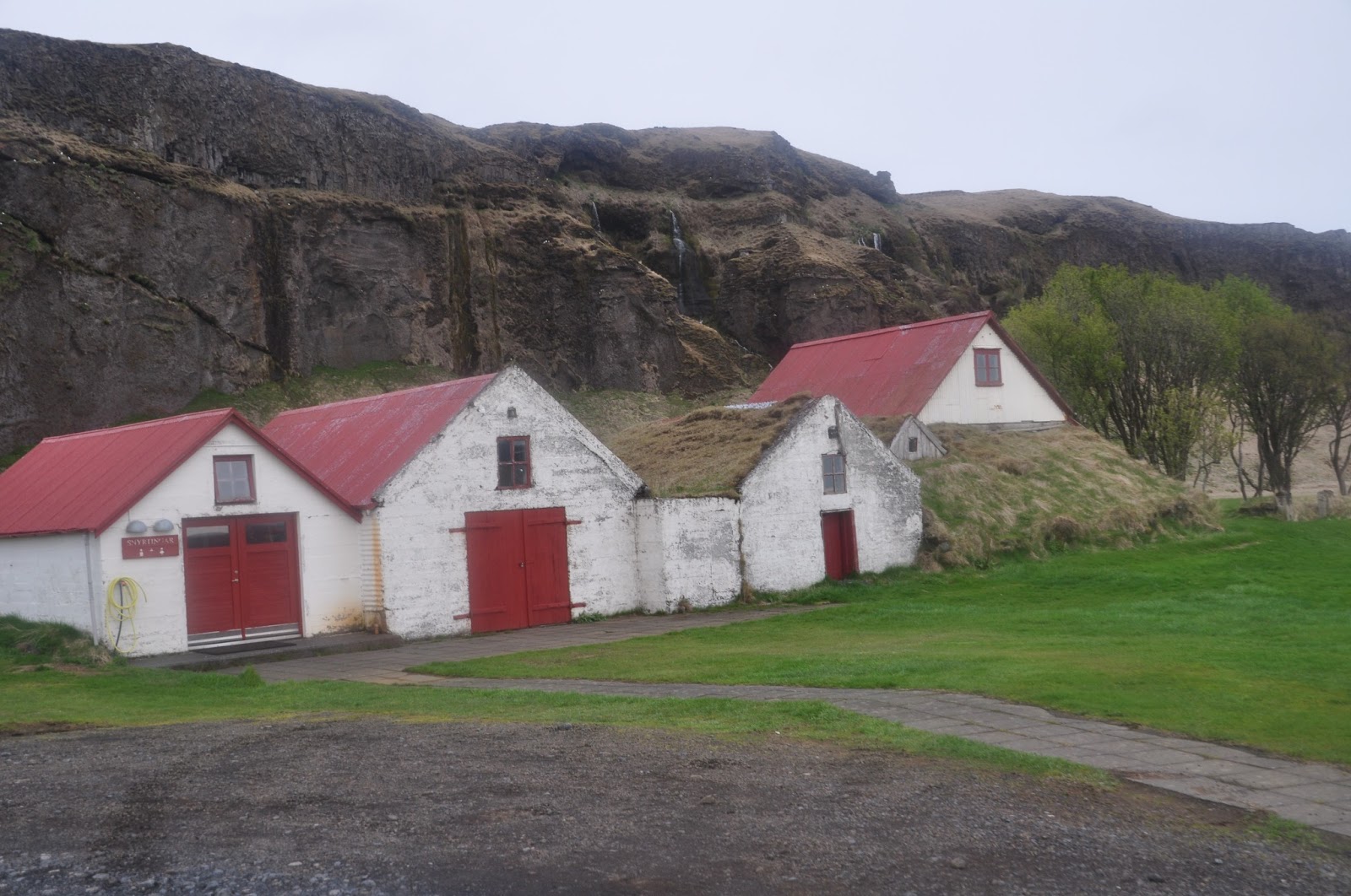
Campsite and waterfall near the west end of Eyafjallajokull
63.621165, -19.987289 |
 |
| This one was responsible for shutting down airports across Europe in 2010 |
 |
| "The Shed" see below |
 |
| Sogafoss (foss=falls) |
 |
| Another bike tourist, this one from Israel. I met three others from Belgium. I spent two night at this campsite. |
 |
| Sogafoss is a stop for all tour buses, as well as regular buses that go each way around the island. |
 |
If you don't like tour buses, consider a "super jeep" tour. Mostly, these climb glaciers.
 |
 |
Oyster Catcher
These should be seen only on ocean beaches and mudflats opening shellfish with their bill.
In Iceland they mostly live in pastures where they have learned to eat worms. |
 |
| This one had a "nest" on the side of the road |
 |
| I addition to the falls, Sogar had a hotel/restaurant |
 |
| Reindeer Tartaric |
 |
| Catch of the day with the best roasted potatoes I have ever had. |
 |
Horsehair rope
Part of the "must see" Sogar Museum |
 |
Onward to Vik
More wind, rain and the finale was a 1.2km 12% hill. |
 |
| Hotel Lundi (Puffin) |
 |
| If these look familiar, you probably saw them in "Lord of the Rings" or maybe "Game of Thrones" which is currently being shot there. |
There are lots of ways to tour Iceland
Gulls nesting on the cliffs
 |
Stayed in Vik for two days since I was promised sunshine on day three
This is Vik from the nearby mountain |
 |
| Arctic Skua attacking |
 |
| Good food |
 |
Leaving Vik
By now I was days behind the optimistic schedule I had planned before leaving Narberth. I therefore decided to end the ride at Hofn, take a bus back to Reykjavik, and spend a few days touring from there. |
 |
Vik is at the lower left and Hofn on the upper right with about 300 km between. Much of the road crosses sand flats created when enormous quantities of water pour from under glaciers when a volcano erupts.
|
It can even rain when the sun is out
Another arctic skua.
Rather than attack like a proper skua, this one patiently waited for handouts at a picnic area
 |
| Wilderness survival |
 |
| The tongue of a glacier. The black curved track running along the right is a Jeep trail. |
 |
| Icebergs in the lagoon at Jokulsarion |
 |
| Another major tourist stop |
 |
| Common Eider |
 |
| Some day I will return and maybe the sun will shine |
 |
Girdi guesthouse
64.128544, -16.013428 |
With another nice restaurant!
 |
Whooper Swan
The plumage should be almost pure white, but iron in the water often stains their head and neck. |
 |
| A pair of Oyster Catchers trying to lead me away from their "nest" next to Highway 1. |
 |
| Reindeer |
 |
| Not many people live here, but every tourist and traveler comes here, so there are hotels and guesthouses along the way. |
 |
| Usually with a really good restaurant! |
 |
The "National Drink"
Its a potato vodka, somehow flavored with cumin. |
 |
| Brewed with glacial water and thyme that grows along the base of the glacier. |
 |
| Hofn |
 |
Hofn Campground
64.258094, -15.202130 |
 |
| I arrived at Hofn in late morning and spent the day riding an unloaded bike into the countryside. |
 |
| If in Hofn, eat here! It was just after 10 pm when I left, and the sun was still up. |
 |
Back to Reykjavik.
The two young back packers on the next bench were from Korea.
A common and practical way to tour Iceland is to backpack, and take buses between towns, trails, hostels, and tourist attractions. |
 |
| The bus stopped at places I had seen before, but now the weather was better. |
 |
| The Reykjavik Campground (it will have 500-1000 tents in July and August) |
 |
| Baby Eider in Reykjavik harbor |
 |
| Boat Tour |
 |
| Puffins nest in burrows they dig in the ground. |
 |
| Puffin |
 |
From the campground I took a bus tour (more like a large van with only three passengers that day).
We visited Geysir, Gullfoss, and Thingvellir National Park. The route is usually called the Golden Circle.
This is Geysir |
 |
| About every seven minutes |
 |
Thingvellir National Park and Lake Thingvallavatn
|
 |
| The lake has exceptionally clear water, as well a four unique species of arctic chad - biologically isolated since the last ice age. The clear water makes it a favorite with scuba divers. Bring your wet suit, the temperature is 1-2 deg Celsius. |
 |
| The cliff on the left is actually the east wall of the North American continental plate. The Eurasian plate is on the other side of the lake. The move apart a few centimeters each year. The Althing (parliament) met here each year starting in 930 AD. |
 |
| Gullfoss |
Actually, it was a wonderful trip!
Possibilities for the next trip to Iceland. There is a lot of Iceland that I did not see, even along the South Coast. If I do the South Coast again, I might start with a bus ride to Hofn and then ride down-wind to Reykjavik with time for a few side trips, perhaps into the coastal hills, to the small island of Heimaey, and onto the glacier at Katla. I was there from late May to early June, this is before the real tourist season. The weather might have been better if I had gone in July or August, but maybe not. It can rain anytime and it is usually windy. It would certainly have been much more crowded. I never had a problem getting a room, except where they did not exist. I was told by a hotel receptionist that if I wanted a room in mid-August, I should make a reservation in March!
I would also like to tour the fjords of the Northwest Peninsula and visit the northern town of Akureyri. I did this trip alone, which at least eliminated the problem of arguing about where/when to ride, eat, sleep, etc. Another way is to go as a small group with someone in a rented car, or with an organized tour. If I decide to do the northern half of Iceland solo/unsupported, I'll probably make occasional use of the round-Iceland bus service between some of the towns.
It was a great ride and I am eager to do more.